Island Walks
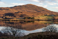
Ben Tianavaig is a 413m (1355ft) high mountain that dominates the Portree skyline. The walk follows the south facing ridge up from the sea level start at the small township of Camustianavaig. The summit offers incredible views overlooking Portree harbour, across to Raasay and up the Sound of Raasay to the Island of Rona. On a clear day you can see for miles.
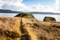
A short walk in Kilmarie which is halfway between Torrin and Elgol. The walk starts by crossing an impressing iron foot bridge over the Kilmarie River and up into the woodland, then out to the headland to explore the Iron Age Broch (fort) and the near coastline. The route returns by following the shore back to the river where you can choose to cross by the large steppingstones or by the bridge where the walk started.

The Gillen walk follows a forestry track that crosses the Waternish peninsula from east to west to reach the beautiful Gillen beach. The clifftop on the west coast offer impressive views down over the beach below then out to sea and the Ascrib Islands. The track down to the beach is steep, but the beach is well worth visiting as it makes a great place to have lunch.

Kingsburgh Forest is a 178 hectare community owned forestry that has two plantations, Glenhinnisdal and Glenuachdarach. The forest consists of birch, oak, willow, spruce and alder trees and is home to wildlife such as eagles and red deer as well as lots of wild plants. This walk has beautiful views over Glenhinnisdal and there is a solid track the whole way.
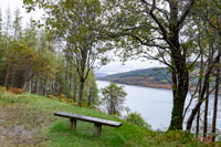
The walk to the Otter Hide is along a forest path by the shore at Kylerhea. The hide is a wooden building that looks out over the sea and allows you to watch the otters down on the shore using the binoculars provided inside the hide. This short walk makes a intresting stopping point to stretch your legs when traveling to Skye using the Glenelg Ferry.
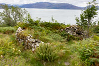
Leitir Fura is walk through a beautiful natural forest that homes lots of oak, hazel and birch trees. The track takes you above the famous Kinloch Lodge Hotel and offers stunning sea views out over the Sound of Sleat and Isleornsay. The route takes you to the historic township of Leitir Fura which is an old village of ruined black houses.
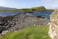
A stunning walk that crosses a tidal causeway from Ullinish to Oronsay Island. The stone causeway has sand each side which makes the water look tropical blue in the right light. The Island has high cliffs that dramatically drop to the sea making it an interesting place to explore. Just take care to get your tide calculation correct so you do not get stranded.
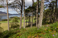
The Island of Raasay makes a good day out. The ferry leaves from Sconser on Skye every 1 to 2 hours and takes 25mins. The walk starts at the ferry terminal on Raasay, the route explores a range of terrains including the beach, forest, ruins of a broch and then returns along the public road after visiting the village of Inverarish.

A long walk from Glen Brittle along a coastal path to the headland where you can explore the ruins of an Iron Age Fort, Viking Canal and a Cairn.
Take a packed lunch as this walk will take most of the day. The route follows a solid gravel track, but does involve some river crossings which can be tricky if the rivers levels are high.

The Rubha Hunish walk takes you to the most northerly tip of the Trotternish peninsula on Skye. The views from the high cliff top are outstanding allowing you look out to sea for miles. On a clear day you can see most of the Outer Isles of Lewis, Harris and Uist. The return route along the shore offers an alternative view of Duntulm Castle.
