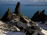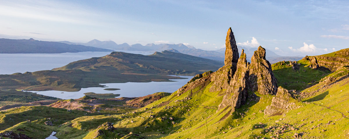
The Old Man of Storr on the Trotternish Ridge is probably the most famous walk, and definitely the busiest attraction, on the Isle of Skye.
The Old Man (Bodach an Stòr in Gaelic), is a 55-metre-high pinnacle of basalt rock which is all that remains of a 2,800-million-year-old volcanic plug.
The Trotternish Ridge (highest summit being The Storr at 719m) was created around 60million years ago by a massive landslip. Hot volcanic lava flowed onto the weaker sedimentary Jurassic rock beneath it causing the latter to collapse and form the undulating cliff faces of the eastern coastline of Trotternish. The magnificent pinnacles and weathered basalt rock formations of The Storr dominates the Island’s north-eastern landscape and can be seen for miles by travellers heading north as well as from the mainland.
The Storr trail uses the same path there and back, starting and returning at the same point (the car park). It covers a distance of 3.8km, with the average time to complete the walk being 1 hour 15 minutes (with no stops).
We have classed this walk as Medium in length and Average for difficulty, check the rating guide for details.
As with most of rural Skye, please enjoy the outdoors responsibly: be mindful of free-roaming livestock; stay on the path; keep dogs on leads at all times; no open fires; take all litter and waste (including dog waste) home; and no flying drones without a UK flyer and operator ID issued by the Civil Aviation Authority.
Location
The Old Man of Storr is situated just off the A855 Portree to Uig road, 6.8 miles north of Portree and 27 miles from Uig. A car journey will take 14 minutes from Portree and 58 minutes from Uig. There is a shorter route from Uig (20 miles, 47 minutes) via the hill road from the turn-off after Idrigil Bay Viewpoint to the Quiraing.
For those who do not have a car, the 57A and 57C Stagecoach bus services stop off at most of the main Trotternish landmarks, but they are infrequent and it is advisable to check the service times with Stagecoach before you set off.
Weather
This walk to the top viewpoint is suitable in most weather conditions. Although there is a good hard gravel path most of the way, some of the terrain is very steep and includes traversing rough stone steps. The top section of the path can get muddy on a wet day and there is always a danger of rockfall along the path at higher levels, so caution and staying on the path is advised. Please take suitable clothing for changes in weather and wear appropriate sturdy footwear for walking. It is also advisable to check the weather on the day you visit. Skye’s highlands are renown for suddenly-descending mist and heavy rainfall may make the walk more difficult in places, especially in the upper parts.
Parking
The 140-vehicle car park is located by the side of the main road just north of Loch Leathan.
There is a toilet, motorhome waste facilities, bike parks and ample space for larger vehicles (with height of over 2 metres) on the allocated roadside spaces. On the opposite side of the road is the tiny Storr View Coffee, selling cakes, home bakes and ice cream alongside teas and coffees.
Ticket machines are dotted around the site and it costs £6 per car for up to 6 hours’ stay and £7 for up to 12 hours. The machines take coins or contactless card.
Drivers are requested not to park on the grass verges or in passing places as this will inhibit the free flow of traffic on the busy road and could hinder emergency vehicles from reaching their destinations in emergencies.
Skye Iconic Sites Project
The area, which sees more than 220,000 visitors a year, is part of a preservation project of the Skye Iconic Sites Partnership and Outdoor Access Trust for Scotland. In order to protect the site from erosion and degradation from increasing visitor footfall, biodegradable GeoJute netting is being used to encourage recolonisation of the surrounding vegetation and minimise erosion. Visitors are requested to heed barriers and signs, avoid the netted areas and stick to the marked trails.
The Walk
Getting to the foot of the Old Man will take about 45 minutes; longer if you stop for rests.
The first stage of the walk formerly passed though farmed pine woodland which was harvested. The walk is, in the main, on a good, firm path all the way up to the viewpoints.
There are a few gates which are double height, designed to keep deer out. Close all gates as you pass through them.
Make sure you look through the Walk Slide Show as it gives a step-by-step account of what you will encounter.
Stage 1
The walk begins through a metal gate flanked by deer fences. The entrance is marked by an information sign. Head though the gate and follow the gravel path that snakes up the hillside.
You will see the stumps of the old forest trees on either side of the path.
After a while the path splits. Both options re-join higher up the slope.
We recommend taking the right-hand side option as the other route is slightly longer.
The path is steep in places but clear in direction. You will reach another metal gate. Pass through.
Follow the path as it zig-zags up the hill, reaching another gate.
Continue uphill. The path then levels out (for now).
Stage 2
Now clear of the old forest area, continue along the path.
Ahead you will see another gate. There is a small pond that was created for an emergency source of water in case of forest fire.
Pass through the gate.
The slope ahead is now grassy with the path climbing upwards. The path becomes slightly rockier as you make your way up.
Take a break often to get your breath and to enjoy the views ahead of the incredible cliff face and the interesting rock structures.
Stage 3
Follow the path and work your way uphill. There are steep uneven rock steps on the path, so traverse with care, especially in wet weather.
As you continue uphill the Old Man will be on your right. Ahead are the other iconic pinnacles that shape this unique landscape.
The Old Man of Storr
The path leading upwards is very steep and not suitable for all. It eventually passes between the pinnacles of the Old Man and Needle Rock, with the Old Man on your right.
It is here you can get up close to view the Old Man and the Sanctuary, including Needle Rock (or The Cathedral, so called because of its ‘windows’).
If you wish to get to the very top to take in the stunning views, continue uphill with care to the area called Photographer’s Knoll and the trig point. The path towards this knoll is narrower and walkers will have to give way to each other as they pass. From the top, the views are breathtaking. Look out to sea over the Islands of Raasay and Rona and then beyond to the dramatic mainland of Scotland’s north western shores and mountains. Look north towards the Trotternish Ridge and the Quiraing. Looking south there are views of the Storr Lochs and then on to Portree and the Cuilliins. Get your camera out for a few shots, then maybe find a quiet corner for a spot of lunch.
The Slide Show photographs gives a very careful account of the final section of the walk, please look though the photos.
Stage 4
Heading back uses exactly the same route, but is far easier going as it is all downhill. Allow 30-40 minutes to get back to the car park.

